
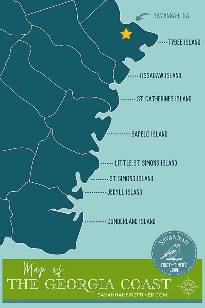
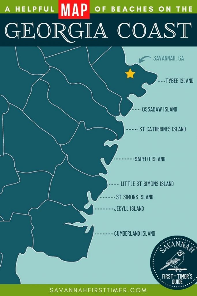
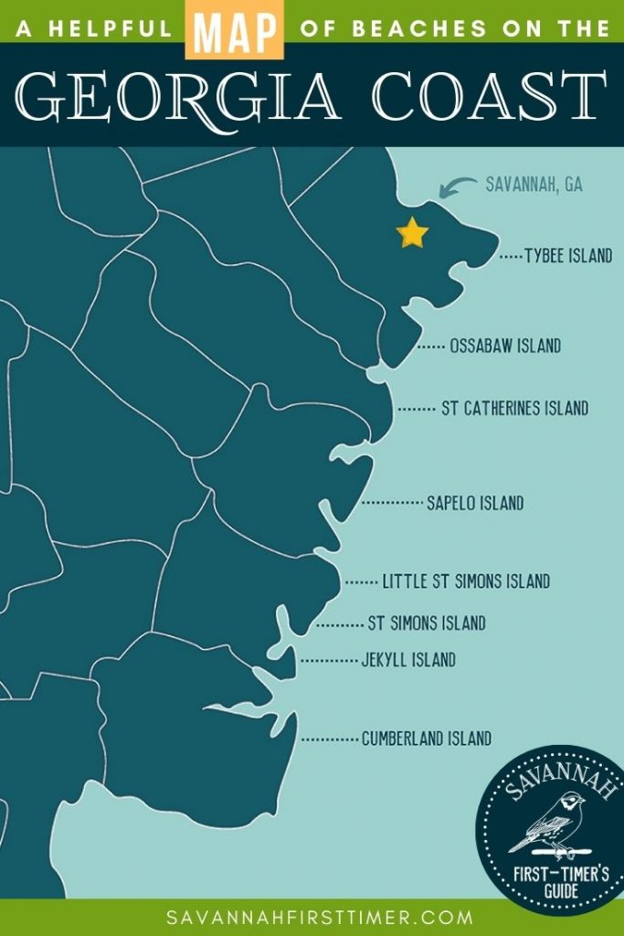
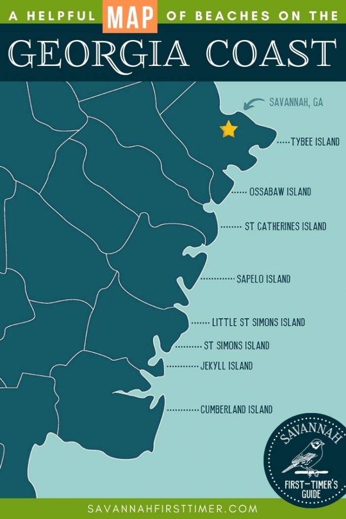
I created this handy Georgia coast map to give you a quick overview of the barrier islands and most popular beaches found along Georgia’s shoreline.
I’ve written in-depth about the pros and cons of each destination here: 7 Incredible Beaches on the Georgia Coast, so I highly suggest reading that post to get the inside scoop on each individual destination!
Tybee Island, Jekyll Island, and St. Simons Island are popular destinations for families, while Little St. Simons, Sapelo, Ossabaw Island, and Cumberland Island National Seashore are barrier islands with more wildlife than people.
If you’re new around here, first of all… allow me to extend a warm welcome!
My name is Erin, and I authored the Savannah First-Timer’s Guide.
It combines all of my top Savannah tips from this website into one handy downloadable ebook.
Georgia Coast Map
Use this helpful map of the Georgia coastline to see at a quick glance where each island is located.
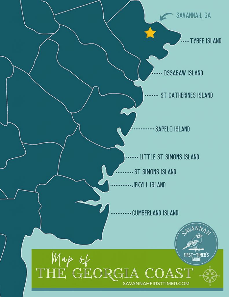
Georgia Coast Map | © Savannah First-Timer’s Guide
🍹Tybee Island, Georgia is the closest beach to Savannah. It has a laid-back vibe, picturesque lighthouse, and lots of casual seafood restaurants.
⛵ St. Simons Island is a nice spot for couples. It’s both upscale and charming, with plenty of shopping, golfing, sailing, and outdoor activities.
🏖️ Jekyll Island is a popular destination for families and photographers. It has a good mix of natural areas and commercial businesses.
🌴 Ossabaw Island is a Heritage Reserve and is culturally significant. It used to be a plantation, and you can visit the cabins where enslaved families used to live.
🐚 St. Catherines Island has a lemur colony living on it! You can only visit by invitation.
🐢 Sapelo Island is home to one of the few intact Gullah Geechee communities left in the United States.
🐊 Little St. Simons Island is a Nature Conservancy.
🌊 Cumberland Island is a National Seashore, so it’s a great place to go hiking or camping.
Get the Inside Scoop on Each Beach: 7 Incredible Beaches on the Georgia Coast
Savannah Travel Blog
If you’re planning a trip to the Georgia coast and want to add Savannah to your itinerary, I have quite a few resources to help you out.
- Free Resources Library: When you sign up for my email list you’ll have access to helpful printables, like my list of 50 things to do on foot in the Historic District (handy if you’re not bringing a car).
- Savannah Georgia Vacation: If you’re not ready to purchase my ebook just yet, this quick-start guide will give you a brief overview of Savannah, including the best time of year to visit and where to stay in the city.
- Savannah First-Timer’s Guide: Once you’ve decided to book a trip, my ebook combines all of my top Savannah travel tips into one handy downloadable guide to make your planning really easy.
I hope that helps! When planning your trip, don’t forget that late August through early October is prime hurricane season along the coast.
If you have any questions for me about this Georgia coast map, please let me know in the comments below.
Love this post? Pin it now to save for later!
Great and helpful…thanks!